September 2, 2014 2:00
Pennsylvania Department of Environmental Protection
The Department of Environmental Protection is creating a public
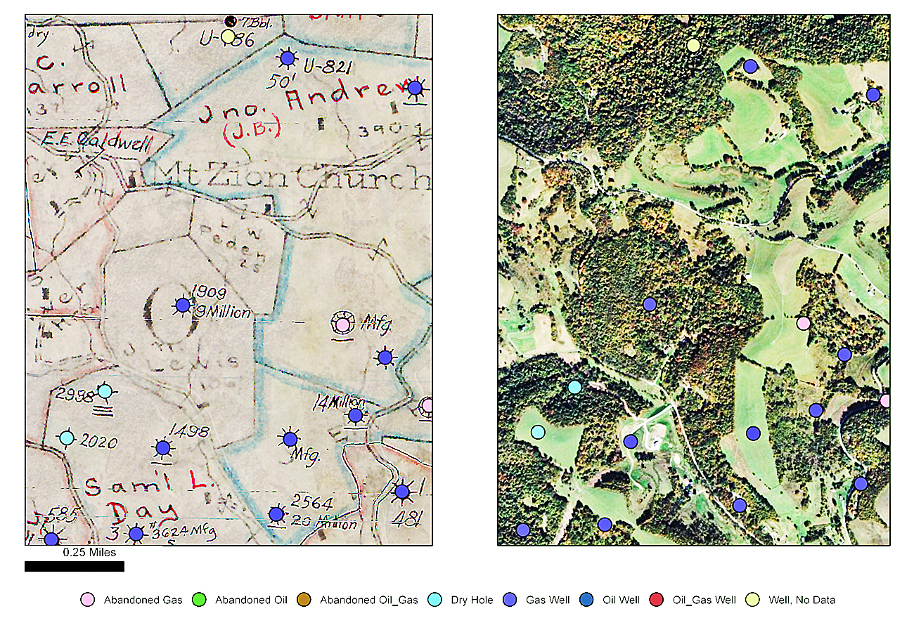
online mapping tool by compiling and digitizing historical maps of
legacy oil and gas wells, like the ones shown above in southwestern
Pennsylvania. Well sites found on a scanned historical source map (left)
are matched with a contemporary aerial photograph (right).
By Laura Legere / Pittsburgh Post-Gazette
Researchers are taking to the archives — and the air — to track down
abandoned oil and gas wells that have left little evidence on the
surface or aren’t marked in modern records.
The Pennsylvania Department of Environmental Protection is gathering
maps made over the last century from the file drawers of other state
agencies, municipal records offices and drilling company libraries. It
is also sharing information with the National Energy Technology
Laboratory, whose researchers flew a helicopter outfitted to detect
metal casings in old wells over three state-owned properties this
summer.
The department’s goal is to digitize both old and new maps, and merge
them in a public online tool that drilling companies can use to scope
out hazards before extracting gas from new wells.
DEP’s list of verified orphaned and abandoned wells includes fewer
than 8,700 sites, but the agency estimates that 200,000 unaccounted for
wells were drilled and abandoned during decades of oil and gas activity
before wells were registered in the state. Pennsylvania began requiring
operators to get permits to drill new wells in 1956 and to register old
wells in 1985.
That doesn’t mean the location of many of the wells is entirely
unknown. Oil and gas companies have passed down and shared old maps for
generations, but no one has ever consolidated and digitized all those
private libraries.
“The goal is to have available a one-stop shop, one location where
any operator could access information on legacy wells, historical
sites,” said Seth Pelepko, the chief of the subsurface activities
section of DEP’s oil and gas program. “This tool would be a way to
ensure that the universe of potential sites is available to operators in
the state.”
The mapping project has new urgency because proposed state
regulations call for drilling companies to identify and monitor
abandoned wells around their operations before and during hydraulic
fracturing, or fracking.
Read more...
http://powersource.post-gazette.com/powersource/policy-powersource/2014/08/29/Mounting-fracking-foes-have-oil-industry-concerned/stories/201408290114

